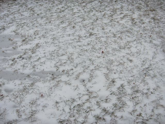
Tässä vaiheessa voimakas kaakkoistuuli oli alkanut tuoda huomattavan kylmää pakkasilmaa ns. Siperian pakkaskorkeapaineen lähestyttyä Suomea koillisesta. Pakkanen kiristyi tämän päivän loppuun mennessä -8,9 asteeseen. Kuvassa nähdään kylmenemisen yhteydessä satanutta kuivaa pakkaslunta, joka tuiskusi parhaillaan kovan tuulen mukana nurmikon korsien sekaan; vertaa 23.12. otettuun kuvaan, jossa lumi oli tarttunut samojen korsien päälle. Kuva on otettu Helsingin Siltamäessä eräässä puistossa. Säätilanne: valitse 17.1.2006; Wetter3 A. Wetter3 B.
At this stage a hard southeasterly wind had been started to bring considerably cold frosty air, when a so called frosty high pressure of Siberia approached Finland from the northeast. The temperature dropped to -8,9 C by the end of the day. In the photo we see snow that had been fallen during the drop of the temperature. The dry frosty snow whirled about at this very moment amongst the blades of grass; compare to the picture taken the 23th of December, where the snow had been grabbed on the same straws. The picture is taken in the district of Siltamäki in Helsinki in some park. Weather condition: choose 17.1.2006; Wetter3 A. Wetter3 B.
Helsingin Puistolan säätilasto tammikuussa 2006 - Weather chart of Puistola, Helsinki in January 2006.
Flickr 1 Flickr 2

posted by Mika at 2:54 PM
![]()


0 Comments:
Post a Comment
<< Home