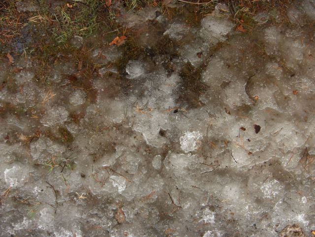
Havupuiden alla lumipeite oli muodostunut talven aikana tyypillisesti muhkuraiseksi, koska puista oli tippunut vaihtelevasti lunta ja vettä. Tässä on kaksi esimerkkiä siitä, kuinka tällainen lumipeite oli jäinen ja voimakkaasti kuviollinen päällimmäisen lumen sulettua ja paljastettua alla kehittyneen jäisen kerroksen tämän kevään alussa. Havupuiden alla oli tässä vaiheessa vähemmän lunta kuin paljaan taivaan alla, mikä johtui ko. puiden sateen varjostuksesta. Lehtipuiden alla em. havaitaan paljon vähäisempänä. Säätilanne: valitse 6.4.2006; Wetter3 A. Wetter3 B.
Under conifer trees the snowcover had been formed typically bumpy during the winter, because snow and water had been dropped variably from the trees. In here there are two examples of how this kind of snowcover was icy and strongly shaped as the topmost layer of the snow was melted and exposed the icy layer formed underneath at the start of this spring. At this stage there was less snow under the conifer trees than under the open sky, which was resulted due to the shading of the trees against the precipitation. Under broadleaf trees the mentioned is seen in a much minor way. Weather condition: choose 6.4.2006; Wetter3 A. Wetter3 B.
Helsingin Puistolan säätilasto huhtikuussa 2006 - Weather chart of Puistola, Helsinki in April 2006.
Flickr 1 Flickr 2

posted by Mika at 5:34 PM
![]()


0 Comments:
Post a Comment
<< Home