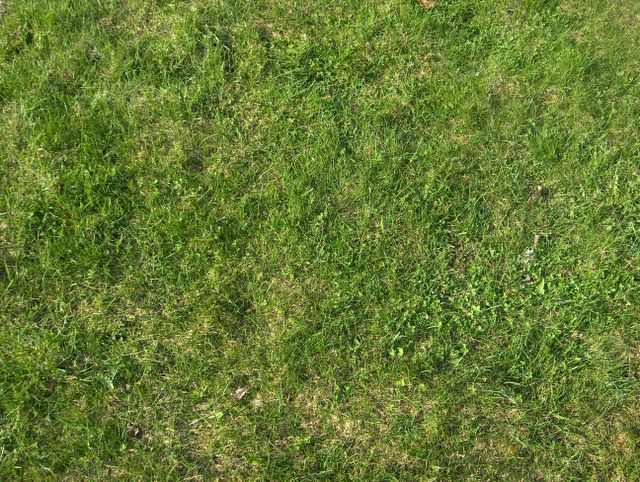
Idässä pitkään vaikuttanut korkeapaine oli tässä vaiheessa siirtynyt eteläisen Suomen ylle ja sen myötä edellisten kahden päivän runsas pilvisyys oli vähentynyt. Kuvauspäivänä tällä Espoon Tapiolan paikalla oli melkein selkeää, mutta iltapäivän kumpupilviä oli lähellä mantereen yllä sisämaassa. Ilma oli koko ajan lämpenemässä ja tämän päivän ylin lämpötila oli +19,1 astetta. Sisämaassa +20 astetta ylitettiin selvästi. Sää oli lämmennyt sen verran jo huhtikuun puolella, että kasvukausi alkoi huhtikuun 25. päivän tienoilla tällä alueella. Kasvukaudeksi määritellään se aika vuodesta, jolloin vuorokausien keskilämpötila on yli +5 astetta. Kasvukauden lämmön määrää kuvataan +5 asteen ylittävien vuorokauden keskilämpötilojen yhteenlaskettuna summana, jolloin ko. summa on termiltään tehoisa lämpösumma ja yksikkönä on aste tai astevuorokausi. Kasvit kasvavat lämmön määrän mukaan (mitä lämpimämpää on, niin sitä nopeammin ne kasvavat). Tällöin tuo termi kuvaa myös sitä, kuinka paljon kasvit ovat kasvaneet tietyn ajan kuluessa. Siitä voidaan päätellä kasvien kehitysasteiden erilaisia tilanteita kunakin hetkenä tarkastikin tehoisan lämpösumman mukaan ja arvioida kasvukauden vaihetta keskimääräiseen tilanteeseen nähden. Kuvassa nähtävä nurmikko oli kasvanut ajankohtaan nähden tyypilliseen tapaan heleän vihreänä uuteen kasvuun, mutta korsien pituus ei vielä edellyttänyt nurmikon leikkaamista. Ruohikkopalojen vaara oli tämän myötä poistunut. Tässä vaiheessa talvella tukahduttavan jään alla kuolleet nurmikon osat näkyivät ruskeina laikkuina muutoin vihreän nurmikon seassa. Säätilanne: valitse Base Time 4.5.2006. Wetter3 A. Wetter3 B.
A high pressure that affected for a long period of time in the east had now been moved over southern Finland and due to that the plentyfull cloudyness of the previous two days had been decreased. In the photoshooting day in this scene in the district of Tapiola in Espoo it was allmost clear, but afternoon cumulus clouds were near over the continent in inland areas. The air was constantly warming up and the maximum temperature of the day was +19,1 C. In the inland areas +20 C was topped clearly. The weather had been warmed up allready in April in such a way, that the growing season was started around 25th of april in this area. The growing season is considered to be that part of the year, when the daily average temperature is above +5 C. The amount of the growing season's warmth is portrayed by the total of the daily average temperatures, which include the readings that are over +5 C. So the term is called an effective temperature sum and the unit is degree or degreeday. The plants grow according to the amount of warmth (the warmer it is, the faster they grow) and therefore that term is describing also, how much the plants have been grown in a certain amount of time. From that can be concluded different growing stages of the plants in any given moment also accurately according to the effective temperature sum and be estimated the stage of the growing season against the average situation. The lawn in the picture had been grown brightly green into new growth typically for the time of the year, but the length of the straws didn't require mowing of the lawn yet. The risk of grass fires had been gone due to this. At this stage spots that were under a suffocating ice layers during the winter appeared as brown patches among the lawn otherwise green. Weather condition: choose Base Time 4.5.2006. Wetter3 A. Wetter3 B.
Helsingin Puistolan säätilasto toukokuussa 2006 - Weather chart of Puistola, Helsinki in May 2006.
Flickr 1 Flickr 2
Tehoisa lämpösumma - The Effective Temperature Sum: 47,9

posted by Mika at 4:42 PM
![]()


0 Comments:
Post a Comment
<< Home