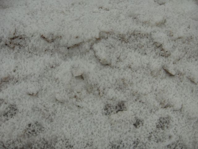
Yllä on viiden kuvan sarja kuvattuna samana päivänä Espoon Tapiolassa. Kuvat on kuvattu kello 11.00. - 12.00., mutta tässä kuvat on sijoitettu järjestykseen taiteellisten seikkojen suhteen ko. aikaskaalan puitteissa. Kuvien tilanteessa Etelä-Suomi oli pohjoisessa olleen pakkasilman ja etelässä olleen keväisen ilman rajavyöhykkeellä, jossa satoi lunta, räntää ja vettä lämpötilan oltua enimmäkseen plussalla koko päivän +1,5 asteeseen saakka. Tässä kuvassa nähdään lehtipuun alla ollutta lunta, jossa alimmaisena oli vanha osittain sulanut lumikasa ja sen päällä ko. päivän ja edellisen yön aikana satanutta uutta märkää lunta. Tähän päälle puusta tippui koko ajan tuoreen lumen sulamisvettä, mikä havaitaan tuon lumen pinnan reikäisyydestä. Säätilanne: valitse 29.3.2006; Wetter3 A. Wetter3 B.
There is five picture series above as pictured in the same day in the district of Tapiola in Espoo. The photos are captured between 11 am and 12 pm, but in here the photos are placed according to artistic matters in that time scale. In the situation of the pictures southern Finland was in the borderline of a northern frosty air and a southern springlike air, where the precipitation came in the form of snow, sleet and rain as the temperature was allmost all day above freezing point up to +1,5 C at the highest. In this picture we see snow that was under a broadleaf tree, where on the bottom was a old and partly melted pile of snow and on the top of that wet new snow as fallen during this day and the night before. On the top of this a melting water of the fresh snow dropped all the time from the tree, which is observed from the perforated surface of that snow. Weather condition: choose 29.3.2006; Wetter3 A. Wetter3 B.
Helsingin Puistolan säätilasto maaliskuussa 2006 - Weather chart of Puistola, Helsinki in March 2006.
Flickr 1 Flickr 2

posted by Mika at 11:26 AM
![]()


0 Comments:
Post a Comment
<< Home