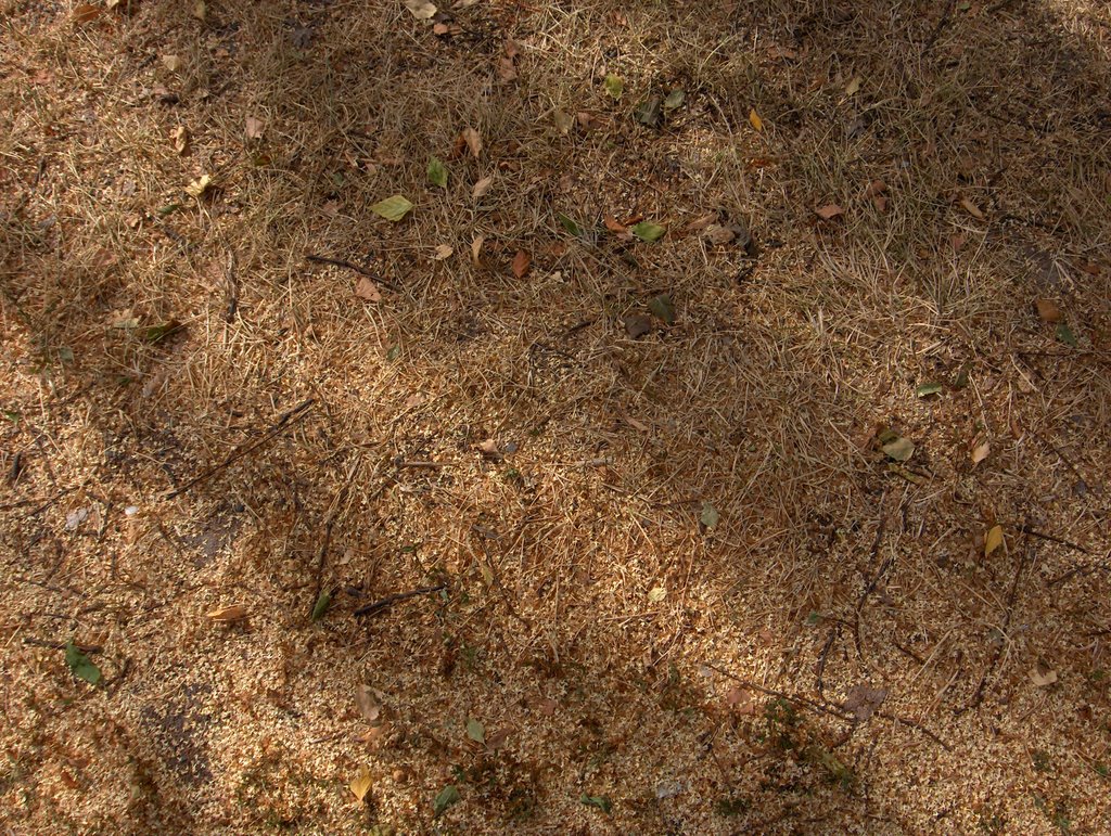
Helteinen sää vaihtui 26. päivän jälkeen tavanomaiseksi kesäsääksi lämpötilojen suhteen; olivat päivisin +20 ja +25 asteen välillä ja öisin +10 asteen vaiheilla. Kuivuus sen sijaan jatkoi pahenemistaan, mutta tässä vaiheessa sen eteneminen oli vähän hitaampaa kuin kuun alussa. Se johtui yhtäältä siitä, kun pimentyneiden öiden (kesäpäivänseisaus oli jo yli kuukausi sitten) aikana kosteutta tiivistyi aikaisempaa enemmän maan pintaan. Toisaalta auringolla ei ollut enää yhtä paljon säteilytehoa kuin kuun alussa. Nämä olivatkin ensimmäisiä merkkejä lähestyvästä syksystä, mutta kesä oli vasta äsken ylittänyt puolivälin termisen määritelmän mukaan. Asiaan vaikutti myös se, että maassa jäljellä ollut kosteus haihtui yhä syvemmältä (kun pintakerrokset olivat yhä syvemmälle kokonaan kuivia), mistä haihtuminen on hitaampaa. Aikaisempien helteiden ja kuivuuden takia koivujen simenentämisvaihe huipentui jo nyt heinäkuun lopulla ja edellisten kuvien jälkeen maahan varisi paikoin todella paljon siemeniä. Yllä olevassa kuvaparissa siitä nähdään esimerkit. Tässä kuvassa tasaisesti laskeutuneiden koivun siementen seassa oli kuivuuden ruskeaksi kuivattamaa nurmikkoa. Nämä siemenet tulivat koivuista, jotka eivät olleet pahasti kuivuuden vaivaamia; vain pieni osa lehdistä oli kellastuneita. Säätilanne: valitse Base Time 28.7.2006. Wetter3 A. Wetter3 B.
The heatwave turned into an average summer weather after the 26th day considering the temperatures; they were between +20 C and +25 C during afternoons and around +10 C at nights. As opposed to that the drought continued getting worse, but at this stage its progressing was a bit slower than at the beginning of the month. It was caused in one hand by the fact, where there condensed more moisture on the surface of the ground during darkened nights (the summer solstice was allready more than a month ago). On the other had the sun didn't have equally as much radiation power anymore as compared to the beginning of the month. Therefore these were the first signs of the approaching autumn, but the summer had been crossed the midway mark only just a moment ago according to a thermal definition. There was affecting to the matter also the fact, where moisture evaporated yet deeper from the ground (as the upper layers of the surface were completely dry further deeper), from where the drying is slower. Due to the previous heatwaves and the drought the seeding phase of the Birch trees peacked allready now during the latter part of July and after the previous pictures there were shed really profusely seeds on the ground. In the pair of photos above we see examples of that. In this picture among the birch seeds there was a lawn turned brown due to the drought. These seeds came from the trees, which weren't harmed badly by the drought; only a small part of the leaves were turned yellow. Weather condition: choose Base Time 28.7.2006. Wetter3 A. Wetter3 B.
Helsingin Puistolan säätilasto heinäkuussa 2006 - Weather chart of Puistola, Helsinki in July 2006.
Flickr 1 Flickr 2
Tehoisa lämpösumma - The Effective Temperature Sum: 935
posted by Mika at 4:04 PM
![]()


0 Comments:
Post a Comment
<< Home